- Home
-
Automotive & Safety
- Accessories & Supplies
- Auto & Motor Parts
- General Safety
- Alarm Systems & Accessories
- Anti-Slip Surfaces
- Child Safety
- Emergency & First Aid Kits
- Eyewear
- Face & Head Protection
- Fall Protection
- Fire Protection & Accessories
- Hearing Protection
- Home Testing Kits
- Knee Protection
- Marking Tapes & Flags
- Personal Safety
- Respiratory Protection
- Safety Clothing
- Smoke & Carbon Monoxide Detectors
- Safety Boot
Top Brands


-
Building & Plumbing
- Electrical
- Batteries & Flashlights
- Cable Reels & Wires
- Ceiling Fans & Accessories
- Circuit Breakers, Fuses & Load Centers
- Doorbells, Chimes & Accessories
- Electrical Boxes & Accessories
- Electrical Connectors, Tape & Terminals
- Extension Cords, Outlets & Accessories
- Interior Light Fixtures
- Light Bulbs & Accessories
- Light Fixture Parts
- Outdoor & Security Light Fixtures
- Portable Work Lights
- Electrical Switches & Sockets
- Home & Industrial
- Plumbing Supplies
- Building And Plumbing Supplies
Top Brands
Other Brands


- Electrical
-
Tools
- Power Tools
- Power Tools & Accessories
- Hand Tools
- Assembly Tools & Accessories
- Axes, Machetes & Shovels
- Chisels, Punches, & Nail Sets
- Concrete & Masonry Tools
- Drywall & Plastering Tools
- Electrical Tools
- Flooring Installation Tools
- Hammers & Screwdrivers
- Hand Saws & Accessories
- Workbenches, Sawhorses & Work Supports
- Spanners, Wrenches & Torque Wrenches
- Welding Machines
- Torque Wrenches & Multipliers
- Hand Tools & Accessories
- Tile Tools
- Tool Aprons, Trolley & Pouches
- Staple Guns & Brad Nailers
- Electrodes, Soldering & Welding Supplies
- Shaping & Marking Tools
- Pry & Wrecking Bars
- Nippers & Pliers
- Mechanic's Tools
- Material Handling
- Logging & Layout Tools
- Knives, Ratchet & Rivet Tools
- Sockets, Hex & Torx Keys
- Glazier & HVAC Tools
- Bricklaying Tools
Top Brand
Other Brands


-
Home & Outdoor
Top Brand

Other Brands


-
 Bosch Hot!
- Pros
- Skilled Professionals
- Architect
- Brick Mason & Brick Layer
- Building Surveyor
- Carpenter
- Civil Engineer
- Concrete Batcher & Block Moulders
- Concreter
- Construction & Building manager
- General Labourers
- Iron Bender (Steel fixer)
- Landscaper & Gardener
- Plasterer
- Plumber
- POP Installers
- Project Engineer
- Roofer
- Site Health and Safety Officer
- Site Engineer
- Stone Driller
- Structural Drafter
- Structural Engineer
- Tiller
- Welder
- Window and Glass Installer
- More Skilled Professionals
- Air Conditioning (AC) Repairer - Home & Industrial
- Air Conditioning (AC) Repairer - Car
- Electrician (House)
- Electrician (Car- Rewire)
- Home Decorator (Interior Designer)
- Mechanic Shop (General)
- Mechanic Shop (Japanese Car Specialist)
- Mechanic Shop (German Car Specialist)
- Mechanic Shop (American Car Specialist)
- Mechanic Shop (Tractors, Trucks and Heavy Duty Machines)
- Painter (House)
- Painter (Car)
- Panel Beater
- Repair Shop (Brush Cutter,Chainsaw & Lawn Mower)
PLUMBER

- Skilled Professionals
Compare (0)
You have no items to compare.
Welcome to Mamtus Nigeria


Details
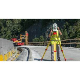
LISCAD Surveying & Engineering Software
Leica LISCAD makes the process from data to plans so simple, you will wonder how you managed without it.
Collecting data may seem the hardest job, but without the right software the data can become a mess. Leica LISCAD allows you to get on with the job straight away.
Software Modules
Purpose made software for the surveyor and engineer for convenience and flexibility, LISCAD is available in modular form so you only need the software necessary to fulfil your daily tasks. For surveyors and engineers alike, LISCAD helps make your work easier, faster and more efficient.
Available modules include:
Input and Output - transfer data to and from total station, data logger, GPS and digital level field surveying devices, as well as software systems including:
- AutoCAD DWG
- MicroStation DGN
- LandXML
Survey Live Field Surveying Software- real-time field surveying and stakeout using total stations and GNSS receivers. Designed for small format tablet computers, the graphical interface combines finger or stylus operation with CAD-type viewing controls. Clearly see your survey build as you go. Survey Live lets you have the power of your office software in the field as you can still access all your other LISCAD functionality.
Point Cloud - import, view, edit and digitise point cloud data. View point clouds in 3D to create point and line objects.
Computations (COGO) - Full geodetic coordinate geometry (COGO) computations based on a selected map projection can be performed using the Computations module to create, edit and examine points, lines, polygons, text and alignments.
Least Squares Adjustment - adjust field surveying measurements with a rigorous least squares solution. Adjust traverse or network frameworks for both horizontal and vertical control.
Transformations - transform between any projections, or compute least squares transformations from coordinate sets.
Digital Terrain Modelling (DTM) - formation is achieved using a geographically indexed data base to ensure fast and accurate formation of triangles on data sets of any size. Once a digital terrain model is formed, the contours can be instantaneously displayed at any interval.
Profiles and Design- create and edit long section and cross sections for CAD output and end area volumes. The Profiles and Design module incorporates an impressive new condition-based system for easy generation of virtually any civil engineering and road design.
Earthworks Volumes - compute an earthworks volume between surfaces, determine surface intersections, create height difference data sets and calculate progressive volumes between planes or irregular surfaces.
Background Images - import orthophotos, satellite images and maps that can be georeferenced to allow for correlation of raster images to vector geometry and for on-screen digitising.
3D Visualisation - a realistic 3D view of your project. Models can be coloured, textured or have background images draped over them. Individual triangles can be easily coloured or textured to give a realistic representation of the model.
Resource Editor - create or edit your own symbols, line styles and fonts for use in all the LISCAD modules.
CAD - application designed specifically for land surveyors and civil engineers to enhance the plan and map production process.
SUPPORTED SENSORS
LISCAD processes surveying data from major surveying manufacturers.
LISCAD SOFTWARE PACKAGES
Survey Pack
Computations and Input/Output - (Input/Output contains Field Transfer, Data Conversions and CAD output)
Contour Pack
Survey Pack and Modelling
Survey Premium Pack
Survey Pack, Adjustment and Transformation
Survey Civil Pack
Contour Pack and Volumes
Survey Civil Pro Pack
Survey Civil Pack and Profiles and Design
Survey Civil Pro Premium Pack
Survey Civil Pro Pack, Adjustment, Transformations, Background Images and 3D Visualisation
EDUCATIONAL
Educational institutes can obtain an education license to include all modules and run stand alone or a network with 10 or more users at a time.
Upgrades: Upgrades from any previous versions are possible
LISCAD is available in
- English (UK and US)
- Dutch
- Finnish
- French
- German
- Korean
- Russian
- Spanish
For more information on LISCAD, including technical details, or to download a free 14 days evaluation license, visit the LISCAD website
Includes:
663246 1 PC. LISCAD Adjustment - rigorous least squares solutions to adjust your field surveying measurements.
663247 1 PC. LISCAD Volumes - compute earthwork volumes between surfaces or a plane, determine surface intersections, create height difference data sets and
compute progressive volumes between surfaces or a plane.
664972 1 PC. LISCAD Profiles & Design - create and edit long and cross sections for CAD output and compute end area volumes. Impressive condition based system for easy generation of virtually any civil engineering and road design.
667052 1 PC. LISCAD CAD - CAD application designed specifically for land surveyors and civil engineers to create and enhance plan and map production.
747041 1 PC. LISCAD Survey Pack includes: Computations and Input/Output.
734713 1 PC. Software protection key (USB) for single user licence.
Additional Information
| Manufacturer | Leica Geosystems |
|---|---|
| Condition | New |
| Warranty | 1 year |
| Tax Class | None |
- Be the first to review this product
Write Your Own Review
Allowed only for defective and wrong items
Mamtus ensures you are satisfied with your purchase - product quality, secure payments and right of returns.
Contact: resolution@mamtus.com and get it resolved in good time.
Also Purchased
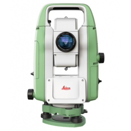
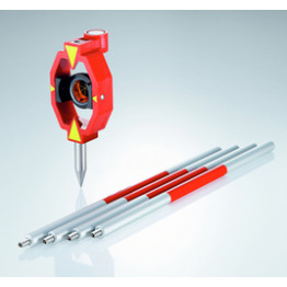
Leica Total Station TS03 5" R500 Basic Package
Regular Price: ₦18,776,970.00
Special Price ₦18,683,085.15
PREPAYMENT ONLY
No cancellation after confirmed payment.
FAST SHIPPING
Guaranteed nationwide 24 - 48hrs delivery anywhere in Nigeria.
₦
EASY RETURNS & MONEY BACK GUARANTEE
ONLINE SUPPORT 24/7
Call or WhatsApp 09091115007, 08168528651, 09091116661 & 09020444474
Delivery Methods
