- Home
-
Automotive & Safety
- Accessories & Supplies
- Auto & Motor Parts
- General Safety
- Alarm Systems & Accessories
- Anti-Slip Surfaces
- Child Safety
- Emergency & First Aid Kits
- Eyewear
- Face & Head Protection
- Fall Protection
- Fire Protection & Accessories
- Hearing Protection
- Home Testing Kits
- Knee Protection
- Marking Tapes & Flags
- Personal Safety
- Respiratory Protection
- Safety Clothing
- Smoke & Carbon Monoxide Detectors
- Safety Boot
Top Brands


-
Building & Plumbing
- Electrical
- Batteries & Flashlights
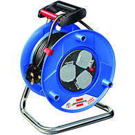
- Cable Reels & Wires
- Ceiling Fans & Accessories
- Circuit Breakers, Fuses & Load Centers
- Doorbells, Chimes & Accessories
- Electrical Boxes & Accessories
- Electrical Connectors, Tape & Terminals
- Extension Cords, Outlets & Accessories
- Interior Light Fixtures
- Light Bulbs & Accessories
- Light Fixture Parts
- Outdoor & Security Light Fixtures
- Portable Work Lights
- Electrical Switches & Sockets
- Home & Industrial
- Plumbing Supplies
- Building And Plumbing Supplies
Top Brands
Other Brands


- Electrical
-
Tools
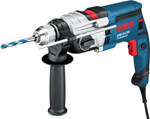
- Power Tools
- Power Tools & Accessories
- Hand Tools
- Assembly Tools & Accessories
- Axes, Machetes & Shovels
- Chisels, Punches, & Nail Sets
- Concrete & Masonry Tools
- Drywall & Plastering Tools
- Electrical Tools
- Flooring Installation Tools
- Hammers & Screwdrivers
- Hand Saws & Accessories
- Workbenches, Sawhorses & Work Supports
- Spanners, Wrenches & Torque Wrenches
- Welding Machines
- Torque Wrenches & Multipliers
- Hand Tools & Accessories
- Tile Tools
- Tool Aprons, Trolley & Pouches
- Staple Guns & Brad Nailers
- Electrodes, Soldering & Welding Supplies
- Shaping & Marking Tools
- Pry & Wrecking Bars
- Nippers & Pliers
- Mechanic's Tools
- Material Handling
- Logging & Layout Tools
- Knives, Ratchet & Rivet Tools
- Sockets, Hex & Torx Keys
- Glazier & HVAC Tools
- Bricklaying Tools
Top Brand
Other Brands


-
Home & Outdoor
Top Brand
Other Brands


-
 Bosch Hot!
- Pros
- Skilled Professionals
- Architect
- Brick Mason & Brick Layer
- Building Surveyor
- Carpenter
- Civil Engineer
- Concrete Batcher & Block Moulders
- Concreter
- Construction & Building manager
- General Labourers
- Iron Bender (Steel fixer)
- Landscaper & Gardener
- Plasterer
- Plumber
- POP Installers
- Project Engineer
- Roofer
- Site Health and Safety Officer
- Site Engineer
- Stone Driller
- Structural Drafter
- Structural Engineer
- Tiller
- Welder
- Window and Glass Installer
- More Skilled Professionals
- Air Conditioning (AC) Repairer - Home & Industrial
- Air Conditioning (AC) Repairer - Car
- Electrician (House)
- Electrician (Car- Rewire)
- Home Decorator (Interior Designer)
- Mechanic Shop (General)
- Mechanic Shop (Japanese Car Specialist)
- Mechanic Shop (German Car Specialist)
- Mechanic Shop (American Car Specialist)
- Mechanic Shop (Tractors, Trucks and Heavy Duty Machines)
- Painter (House)
- Painter (Car)
- Panel Beater
- Repair Shop (Brush Cutter,Chainsaw & Lawn Mower)
PLUMBER

- Skilled Professionals
Compare (0)
You have no items to compare.
Welcome to Mamtus Nigeria


Leica Geosystems
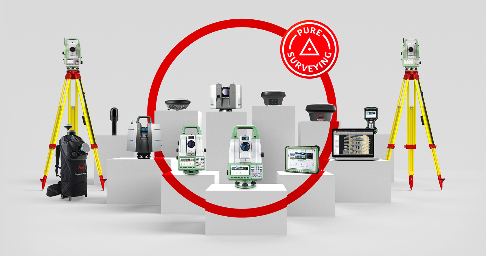
Leica Geosystems based in eastern Switzerland produces products and systems for surveying and geographical measurement. Revolutionising the world of measurement and survey for nearly 200 years, Leica Geosystems creates complete solutions for professionals across the planet. Leica Geosystems offers the ideal system for every GNSS application.
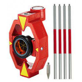
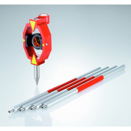
Leica Mini Prism with Aluminum Pole - GMP111
Features
- Prism Constant: +17.5mm
- Accuracy: 2.0mm
- Range: Long range 2000m (7000 ft.)
₦141,277.50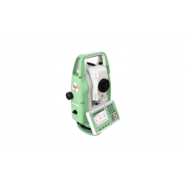

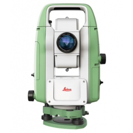
Leica Flexline Total Station TS07 2" R500 Basic Package
Product Description
The high-quality Leica FlexLine TS07 manual total stations are based on a proven product concept that has revolutionized the world of measurement and surveying for almost 200 years.
This available basic package consists of;
- TS07 2"
- Tribrach (W/O optical plummet)
- Tripod
- Prism and pole
- 2 batteries
- Height meter and holder
- Single charger
- AC/DC adapter
- USB Memory stick
- SD Memory card
Note: Configuration depends on Customers Preference or Basic Package available.
₦28,890,790.00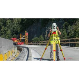
Leica Total Station TS03 5" R500 Basic Package
Leica FlexLine TS03 Manual Total Station TS03 is a classic manual total station for standard measuring tasks, enabling you to carry out most survey and layout tasks easily and efficiently. Be it building construction, civil engineering or surveying and mapping – the TS03 helps you tackle your daily challenges and tasks trouble-free. It is also based on a proven product concept that has revolutionized the world of measurement and surveying for almost 200 years.
This available basic package consists of;
- TS03 5"
- Tribrach (W/O optical plummet)
- Tripod
- Prism and pole
- 1 battery
- Height meter and holder
- Single charger
- AC/DC adapter
- USB Memory stick
- Data transfer cable
- SD Memory card
Note: Configuration depends on Customers Preference or Basic Package available.
₦0.00
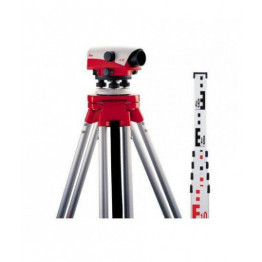
Leica Optical level NA720 Pack + Tripod + 5m staff
Product Description
This shock resistant optical level is of high quality thanks to its compensator with magnetic damping.It is robust, efficient and possible to read the horizontal circle in degrees.
₦1,464,007.50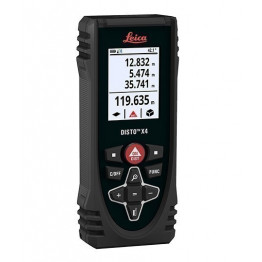
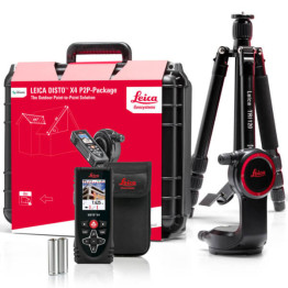
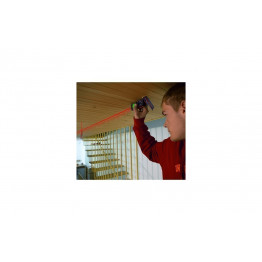
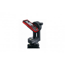
Leica Outdoor Handheld Laser Distance Meter Disto X4, 150m
New Leica Disto indoor / outdoor long distance, very robust and equipped with a color camera. Ideal for measurements under difficult conditions.
Features
- Leveling range: 5 ° with Leica DST 360
- Pointfinder sight with zoom: 4x
- Data interface for 3D points: Bluetooth® Smart
- Battery life: Up to 8 h (reduced if Bluetooth® enabled)
- Multi-function end piece with automatic reference detection: Yes
- Degree of protection: IP 65
- 2m drop resistant: Yes
- Guaranteed for 3 years, delivered with cover and batteries
₦869,400.00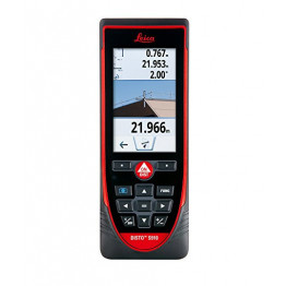

Leica Hand Laser Measure Distance Meter Disto S910
Top-of-the-range Leica distortion for indoor and outdoor measurements. Ideal for your complex measurements thanks to P2P technology.
Features
- Horizontal angle measurement by encoder and vertical angle by inclinometer.
- Saves measurements in AutoCAD (DXF) format.
- Transfer of point coordinates in real time via wifi.
- Long range up to 300 meters, Integrated mini tripod, Hotline included in the price.
- Calculation of inaccessible measurements with P2P technology - Measures all distances between 2 points (horizontal, vertical, incline, slope calculation ...)
- Calculation of complex areas: Even the most complex area calculations are simplified.
- Frame the perimeter by recording the points and the area will be automatically calculated from a single position: walls, ceilings, inclined planes ...
- Calculating angles: measure all angles, even on sloping surfaces.
- Reading with Dxf file All your measurements are recorded in 2D or 3D Dxf format that you can then retrieve and process on your software.
- Real-time point transfer via WiFi Send measurements or coordinates of the point directly via WiFi to CA software
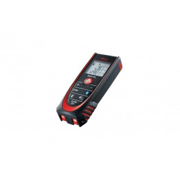
Leica Handheld Laser Distance Measure with Bluetooth DISTO D2
Disto for interior measurements. Certified range up to 100 m. Waterproof and dustproof.
Features
- Bluetooth transfer : transfer via bluetooth technology allows you to immediately transfer your values to your mobile applications such as Excel, Word, planning software, autocad, etc.
- Large range : the new Disto D2 Bluetooth rangefinder has a range of 100m compared to the 60m of the first version.
- Pythagorean function: automatic calculation on 2 points and 3 points.
- Automatic clip: The clip at the foot of the rangefinder is now automatic thanks to the integrated sensor, no need to navigate in the menu to choose the zero point of the rangefinder.
₦462,000.00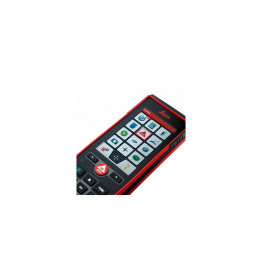
Leica Laser Distance Measure 250M Range D810
- Long range indoor / outdoor distortion.
- Has a color touch screen.
- Rechargeable and waterproof.
- Compatible with IOS / ANDROID / APPLE

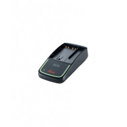
Leica Batteries Charger GKL311 for Leica GEB211 to GEB242
Product Specification
It charges the batteries in about 8 hours.
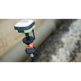
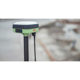
Leica GS05 GNSS RTK Rover
A new lightweight compact GNSS antenna with tilt compensation and an immunity to magnetic disturbances.
₦0.00
Loading ...Load More ...
Delivery Methods
