- Home
-
Automotive & Safety
- Accessories & Supplies
- Auto & Motor Parts
- General Safety
- Alarm Systems & Accessories
- Anti-Slip Surfaces
- Child Safety
- Emergency & First Aid Kits
- Eyewear
- Face & Head Protection
- Fall Protection
- Fire Protection & Accessories
- Hearing Protection
- Home Testing Kits
- Knee Protection
- Marking Tapes & Flags
- Personal Safety
- Respiratory Protection
- Safety Clothing
- Smoke & Carbon Monoxide Detectors
- Safety Boot
Top Brands


-
Building & Plumbing
- Electrical
- Batteries & Flashlights
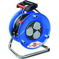
- Cable Reels & Wires
- Ceiling Fans & Accessories
- Circuit Breakers, Fuses & Load Centers
- Doorbells, Chimes & Accessories
- Electrical Boxes & Accessories
- Electrical Connectors, Tape & Terminals
- Extension Cords, Outlets & Accessories
- Interior Light Fixtures
- Light Bulbs & Accessories
- Light Fixture Parts
- Outdoor & Security Light Fixtures
- Portable Work Lights
- Electrical Switches & Sockets
- Home & Industrial
- Plumbing Supplies
- Building And Plumbing Supplies
Top Brands
Other Brands


- Electrical
-
Tools
- Power Tools
- Power Tools & Accessories
- Hand Tools
- Assembly Tools & Accessories
- Axes, Machetes & Shovels
- Chisels, Punches, & Nail Sets
- Concrete & Masonry Tools
- Drywall & Plastering Tools
- Electrical Tools
- Flooring Installation Tools
- Hammers & Screwdrivers
- Hand Saws & Accessories
- Workbenches, Sawhorses & Work Supports
- Spanners, Wrenches & Torque Wrenches
- Welding Machines
- Torque Wrenches & Multipliers
- Hand Tools & Accessories
- Tile Tools
- Tool Aprons, Trolley & Pouches
- Staple Guns & Brad Nailers
- Electrodes, Soldering & Welding Supplies
- Shaping & Marking Tools
- Pry & Wrecking Bars
- Nippers & Pliers
- Mechanic's Tools
- Material Handling
- Logging & Layout Tools
- Knives, Ratchet & Rivet Tools
- Sockets, Hex & Torx Keys
- Glazier & HVAC Tools
- Bricklaying Tools
Top Brand
Other Brands


-
Home & Outdoor
Top Brand
Other Brands


-
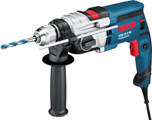
 Bosch Hot!
- Pros
- Skilled Professionals
- Architect
- Brick Mason & Brick Layer
- Building Surveyor
- Carpenter
- Civil Engineer
- Concrete Batcher & Block Moulders
- Concreter
- Construction & Building manager
- General Labourers
- Iron Bender (Steel fixer)
- Landscaper & Gardener
- Plasterer
- Plumber
- POP Installers
- Project Engineer
- Roofer
- Site Health and Safety Officer
- Site Engineer
- Stone Driller
- Structural Drafter
- Structural Engineer
- Tiller
- Welder
- Window and Glass Installer
- More Skilled Professionals
- Air Conditioning (AC) Repairer - Home & Industrial
- Air Conditioning (AC) Repairer - Car
- Electrician (House)
- Electrician (Car- Rewire)
- Home Decorator (Interior Designer)
- Mechanic Shop (General)
- Mechanic Shop (Japanese Car Specialist)
- Mechanic Shop (German Car Specialist)
- Mechanic Shop (American Car Specialist)
- Mechanic Shop (Tractors, Trucks and Heavy Duty Machines)
- Painter (House)
- Painter (Car)
- Panel Beater
- Repair Shop (Brush Cutter,Chainsaw & Lawn Mower)
PLUMBER

- Skilled Professionals
Compare (0)
You have no items to compare.
Welcome to Mamtus Nigeria


Leica Geosystems
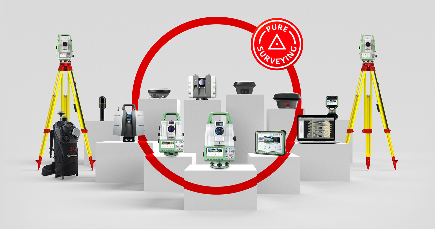
Leica Geosystems based in eastern Switzerland produces products and systems for surveying and geographical measurement. Revolutionising the world of measurement and survey for nearly 200 years, Leica Geosystems creates complete solutions for professionals across the planet. Leica Geosystems offers the ideal system for every GNSS application.
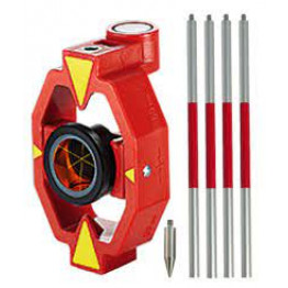
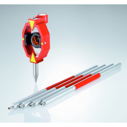
Leica Mini Prism with Aluminum Pole - GMP111
Features
- Prism Constant: +17.5mm
- Accuracy: 2.0mm
- Range: Long range 2000m (7000 ft.)
₦141,277.50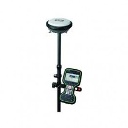
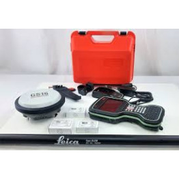
Leica Viva GS16 GNSS RTK Base and Rover
Leica Viva GS16 GNSS RTK Base and Rover
- Pairs with the Leica CS20 controller or Leica CS35 tablet and achieve the ultimate in control and convenience with complete mobility.
- Touch screen technology allows for comfortable and quick data processing while a stunning 3D view transforms your Leica Viva GNSS experience.
- Complete RTK rover package with L2, L5, L-band tracking plus GLONASS paired with a Leica CS20 controller with Leica Captivate SW- Measure and Stakeout.
₦25,357,500.00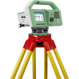
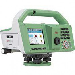
Leica LS10 Digital Level
Features
- Eliminate delays with superior technical service
- Finish jobs faster with excellent consultancy support
- Avoid costly site revisits with online service to send and receive data directly from the field.
₦10,294,091.84
Liscad Surveying & Engineering Software
Features
- Leica LISCAD is a surveying and engineering software package that allows data from virtually any surveying instrument to be imported and turned into finished plans.
- It is a complete field-to-finish system trusted by surveyors in over 100 countries. LISCAD interfaces with all major surveying, engineering, GIS and CAD systems.
- LISCAD’s portfolio comprises of integrated Land Surveying and Civil Engineering.
₦244,513.50
Loading ...Load More ...
Delivery Methods
