Questions? Feedback? powered by Olark live chat software

Flexible Shipping & Payment Options
Place Order on Phone: (+234) 902 04 44474
                                            (+234) 816 85 28651

0item(s)

You have no items in your shopping cart.

Product was successfully added to your shopping cart.

Laser Levels & Survey Instruments

Set Descending Direction


Items 1 to 10 of 83 total

  1. 1
  2. 2
  3. 3
  4. 4
  5. 5
  1. Leica Automatic Dumpy Level, NA730 Plus + Tripod + rod

    Leica optical construction level with 30x telescopic magnification.

    Advantages of the Leica NA730 plus construction optical level: 

    • Robust
    • Specific
    • High quality Leica optics
    • The best of its range

  2. Leica Laser Distance Measure 250M Range D810

    • Long range indoor / outdoor distortion. 
    • Has a color touch screen.
    • Rechargeable and waterproof. 
    • Compatible with IOS / ANDROID / APPLE

  3. Leica Prism Pole 2.15m GLS11

    Product Description

    Prism Pole is an ideal for measuring the elevation of a specific ground point by using a sight level, which is important if you want to get accurate results.

    . Leica offers you its GLS11 rod with "Quick release" clamping by lever, telescopic from 1.23 m to 2.15 m.

    . It has an adjustable 8 'spherical level . The graduation is done in cm and in ft .

    . The tip is not interchangeable.

  4. Leica Tribrach with Optical Plummet Professional 3000 series GDF312

    Products Description

    The LEICA GDF312 base is a good compromise between precision quality and price . It can be used for topography work requiring long exposure. Its torsional stiffness is <3 ", which makes it quite robust .Also affixes a surveying instrument, such as a total station, theodolite, or GNSS antenna, to a tripod. It allows the instrument to be placed over the same surveying point precisely.

  5. Leica Tribrach without Optical Plummet Professional 3000 series GDF311

    Products Description

    The LEICA GDF311 base is a good compromise between precision quality and price . It can be used for topography work requiring long exposure. Its torsional stiffness is <3 ", which makes it quite robust .Also affixes a surveying instrument, such as a total station, theodolite, or GNSS antenna, to a tripod. It allows the instrument to be placed over the same surveying point precisely.

  6. Leica Viva GS16 GNSS rover self-learning Smart Antenna

    • Features -
    • Measurement precision, Accuracy, reliability and time for initialisation are dependent upon various factors including number of satellites, observation time, atmospheric
    • conditions, multipath etc.
    • Figures quoted assume normal to favourable conditions.
    • Creates complete solutions for professionals across the planet.
    • Known for premier products and innovative solution development, professionals in a diverse mix of industries, such
    • as aerospace and defence, safety and security, construction, and manufacturing,
    • Trust Leica Geosystems for all their geospatial needs.
    • With precise and accurate instruments, sophisticated software, and dependable services,
    • Leica Geosystems delivers value every day to those shaping the future of our world

    Please note; customer who purchased this will also need the Base to work with.

    for more information - Leica Viva GS16 data sheet


  7. Leica GS18 T GNSS RTK Rover LTE & UHF Performance Smart Antenna

    Features /Benefits

    • Engaging Software
    • Tilt Compensation
    • Internal Memory
    • 4G LTE / Excellent Measurement Quality
    • Improved Performance and excellent customer care . 
    it is the user-friendly geospatial office software for the measurement professionals. It is designed to manage, process, analyse and quality check all field survey...
     
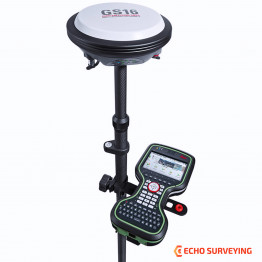
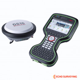
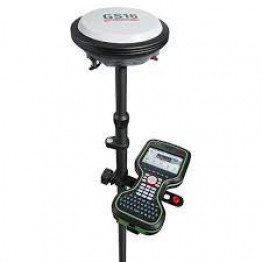
    Please note that customer who purchased this also needs the base 
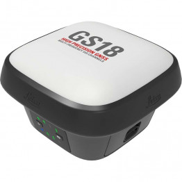
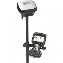


  8. Leica Detect Smart Locator - DD230

    Product Highlights

    The Leica DD230 is an easy to use, intuitive locator simplifying the detection of buried utilities and increasing user confidence .With automated pinpointing technology and a clear visible display, the DD230 discovers buried utilities with confidence, even in densely packed areas. On-board video support, usage alerts and diagnostics, combine to improve product use and, protect operators and utilities.

  9. Leica Mini Prism with Aluminum Pole - GMP111

    Features 

    • Prism Constant: +17.5mm
    • Accuracy: 2.0mm
    • Range: Long range 2000m (7000 ft.)
  10. Leica Aluminum Staff 5m CLR102

    Products Description

    A level staff, also called levelling rod, is a graduated wooden or aluminium rod, used with a levelling instrument to determine the difference in height between points or heights of points above a vertical datum. It cannot be used without a leveling instrument.